 |
|
Milton McCrystal and I spotted Callaghan on the northern horizon in 1996 from the summit of a popular hike, Mount Brandywine. The map showed a 17 km forest road that ran north from the highway into the valley west of Whistler. It ended at Lake Callaghan. Beyond, there was nothing but wilderness and the vast Pemberton Icefield. The peak of Callaghan is 7 km west and north of the end of the road. I really wanted to find out what I had to do to go there.
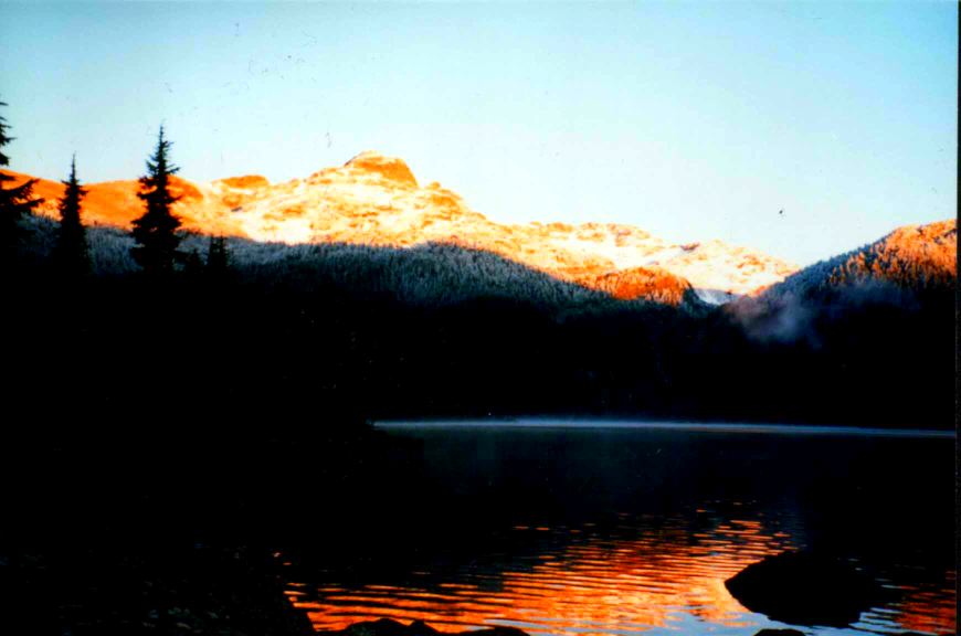
Our first attempt was a month later, September 22. Here is Lake Callaghan at dawn with Peak 7495 behind. Peak 7495 is at the eastern end of the Callaghan massive.
After an ugly bushwhack we made it to the alpine benches and could see the peak we would not reach that day. We were actually close to a good route. The basin on the right became our route to success, years later. For me, the location is exotic, and the views are stunning. Joined to Callaghan by a saddle to the west is Ring Mountain. To the south is the dome of Powder Mountain; named in the hopes of making a ski hill there. It is actually a névé that tops the divide between the Whistler corridor and the Squamish River. That day, as we descended to Callaghan Lake I slipped in a swampy patch in the trees and ruptured a ligament.
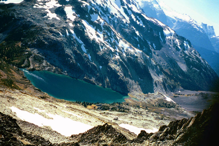
We were back a year latter to try the guidebook route. We slogged our way through the low altitude swamps and finally rounded the beautiful Upper Lake. That is Callaghan on the left (you cannot see the peak) and Ring is behind us. We made it to the saddle between Ring and Callaghan, and for the first time we saw the Pemberton Icefield with Little Ring in the foreground. That was 13 hours on the trail, and an exit by headlamp. Having walked around most of this hill, we decided that the Southeast Ridge route should be easier. We did a short day trip on the snow on Remembrance Day 1997, to reconnoiter a route through the bluffs of the lower ridge. As soon as we could see a clear path to the alpine, we declared the day a success, took a break where there was a great view, and repaired to Whister in time for the Crystal Lounge deal on wings and beer. In 1999 we returned one day to tape the bushwhack up the SE ridge and came back a week later with skis. The route was fine, but we went too high on a ridge just below Peak 7495. We kicked our way up the little couloir on the right of the picture to reach the summit ridge that day, but we were still 3 km from the peak. Nice ski down -- and it was August! After this we decided that the summit was a 2-day trip.
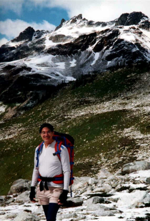
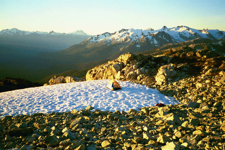
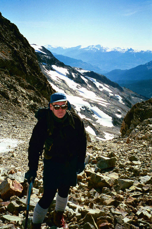
On October 4, 2000, Milton and I headed out. A fatal car accident blocked the Whister highway from 8 am to 11 am, so it was just after noon when we crossed the Callaghan Creek. An hour later we began our bushwhack off the trail and up the SE Ridge. It was very dry so we wanted to camp near snow for water. We made it to a great location for our camp just at sunset. Behind Milton is Ipsoot Mountain, the dome just west of Pemberton.
We were up at 7:15. Magnificent weather! In the picture you can see the Black Tusk, a hint of Garibaldi, and the pointy bump on the right is Brandywine. Looking to the right we could see Brandywine on the next ridge south, and beyond that is the sharp fins of Mount Fee, and in the distance the misty towers of Tantalus. We rose, skipped a cooked breakfast, prepared our kit, and were hiking shortly after 8.
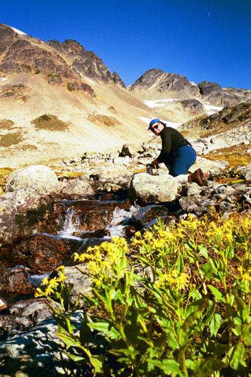
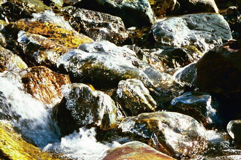
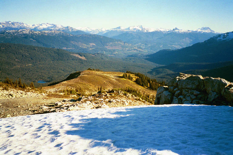
The route is along the open alpine benches so there is always a fine view. Four years after our first hike, we were back in the basin that we hoped would lead to the top. We were overjoyed to find that water was plentiful and delicious. In spite of the sun, the air was cool, and the rocks in the creek were sheathed in ice.
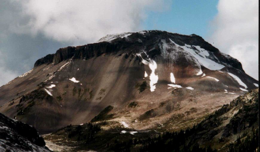
At the top of the basin there is a snow route to a lovely little cirque just below the summit ridge. From the cirque, there is a steep boulder chute up to the glacier. We had no idea what we would encounter when we emerged from the chute.
We found the top of the glaciers on the north side of the mountain. It is a rolling landscape vast enough for a whole town -- a névé. And there, less than a kilometer away, is the summit. We were amazed to see that the whole north face of the summit rocks have recently shattered, and much of the debris is deposited on the glacier. Our route to the top is up the ledge behind that tongue of snow on the left. That tongue is really a treacherous snow bridge over a nasty hole. The loose rock makes the ledge the most uncomfortable part of the trip. Milt has just rounded the difficult corner, and I am just below the peak casting my shadow unprofessionally into the picture.
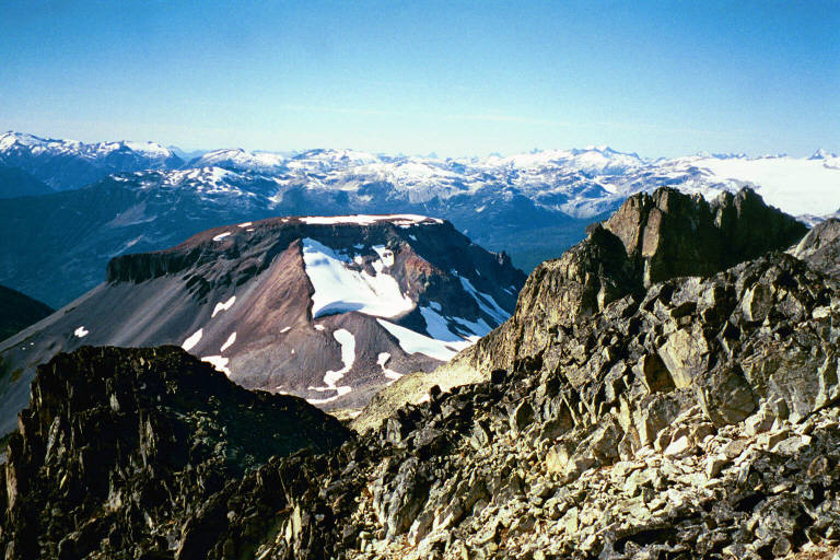
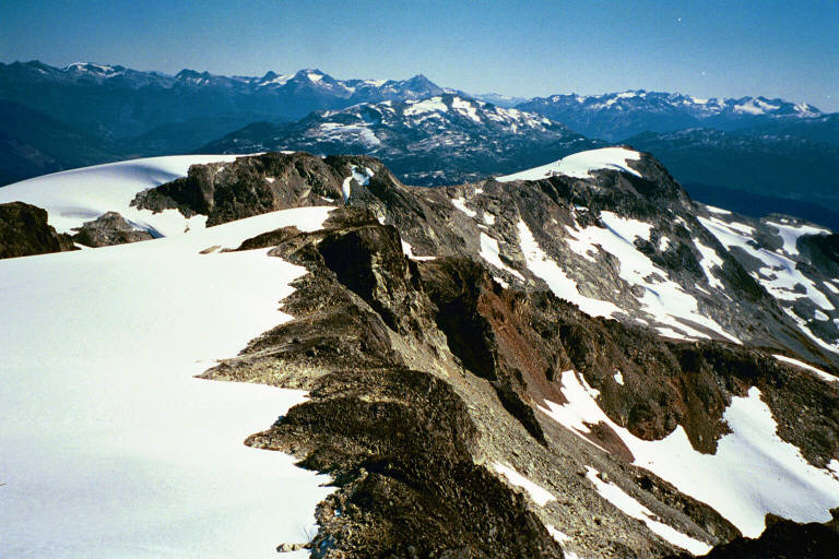
A few moments later we were at the summit. We didn't actually stay at the peak for any time because the fresh fractures in the rock were visible and we didn't want to contribute to any further destruction of this hill. So we sat with our heads just at the summit level on safer rock. Let me say that these pictures just don't tell the story. There was not this much blue haze and the vista is a 360 degree panorama that beggars Imax. Now we were looking down on Ring with the Elaho in the distance. The wind was almost calm. We were on the south side looking down the Whistler-Squamish divide. We could see some of our route along the benches. And we could look down on the Upper Lake. Along the summit ridge we could see Rainbow Mountain. To the right of Rainbow are the runs of Blackcomb. Looking over the peak to the northeast, we could see the fallen rock on the glacier with Ipsoot and more distant peaks. We left the top about 1 pm.
There was a long way to go before dark. Going down on snow is fun, and we could do some glissading. It was after 4:30 when we broke camp and headed down the ridge trying to move fast enough to have light to find the trail. We made it down through the maze of bluffs and gullies, and into the forest while we could see our way. During the lower bushwhack we were using my compass and the first quarter moon to navigate. We bashed forward recklessly with me counting down our elevation on my altimeter. At 4040 Ft. and 7:20 pm Milton announced he was on the trail. A stop for water and food and we used our headlamps to march to the car, arriving at 8:15 pm.
I am always interested to know who visits the sections of this website. So, if you read this, please drop me a note at robert@ballantyne.com
Robert J. Ballantyne
2000 October
Return to Client Page
Review the process to A Better Decision
Return to the Ballantyne & Associates' home page